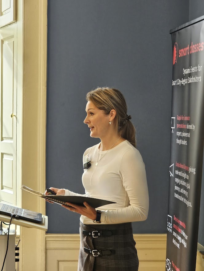
Ruth White heads up one of the City of Edinburgh Council’s Strategy and Development teams within the Transport Strategy and Partnership service area. She’s passionate about placemaking and ensuring that streets and spaces are inclusive, healthy, welcoming and safe for everyone. Her enlightening keynote at TRANSPORT Smart Class, Scotland 2025 explored the city’s suite of Street Design Guidance, developed to enable consistent and best practice decision-making to guide the reshaping of existing streets and inform the design of new streets.
The creation of Edinburgh’s Street Design Guidance is collaborative, and Ruth’s presentation set out the partnership working involved, in particular with the city’s Planning service.
Ruth shared examples of projects where the Street Design Guidance is bringing critical disciplines together including heritage, accessibility, and women’s safety and guiding the delivery of award-winning projects on the ground. She also touched on the strategic context of the Street Design Guidance including the city’s Future Streets Framework, City Mobility Plan, and City Plan.

Summary of presentation highlights:
- Population Growth…
- Scottish population growth is expected to continue to be highest in the wider Edinburgh region: 2018-2028 – Midlothian (+13.8%), East Lothian (+7.2%), City of Edinburgh (+6.6%);
- According to National Records of Scotland estimates (2025) – From 2014 to 2024, Edinburgh’s population grew by 9.4% (estimated 45,410 people); Scotland’s population growth is highest around Edinburgh and the wider region; Midlothian is the fastest growing local authority, followed by East Lothian and City of Edinburgh;
- Land to accommodate 53,000 new homes by 2030 is being provided to meet the needs of Edinburgh’s growing population (Edinburgh’s City Plan 2030);
- Edinburgh is ranked as having the 3rd worst congestion in the United Kingdom (TomTom Traffic Index 2024); The cost of congestion to drivers is £494 per year (INRIX 2024);
- Edinburgh’s population is estimated to double to one million every August during the Fringe festival;
- Transport in Edinburgh…
- 2315 average daily cyclists travelling on Leith Walk; 65% of Edinburgh’s residents don’t use private cars to travel to work (Scottish Household Survey 2023); 66% of Edinburgh residents walk or wheel at least five days a week (Walking and Cycling Index 2023); 45% of all Edinburgh residents cycle (Walking and Cycling Index 2023);
- Public transport satisfaction in Edinburgh is 86%, which is >20% over the Scottish average and the highest in Scotland (Scottish Household Survey 2023); 28% of Edinburgh’s residents take the bus to work, the highest rate in Scotland (Scottish Household Survey 2023);
- Comparison of road space for different travel modes – 50 pedestrians vs. 50 cyclists vs. 50 people on a bus (full capacity is 80-100 people) vs. 50 people on a tram (1.5 carriages of a standard tram) vs. 50 people in cars (assuming 1.5 person occupancy);
- The Council now have 20mph in the city centre and will be rolling this out to other key areas over the coming year; Many of the new schemes the Council are delivering are taking into account the 20mph – Leith Walk, for example;
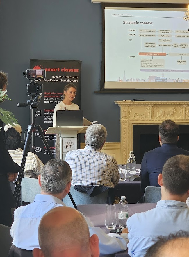
- What’s the purpose of Edinburgh’s Street Design Guidance?
- Vision – “Edinburgh will be connected by a safer and more inclusive net zero city transport system delivering a healthier, thriving, fairer and compact capital city and a higher quality of life for all residents” (City Mobility Plan): Council’s 10 year vision involves transforming Edinburgh’s streets – ‘Our Future Streets’; Gives designers tools to deliver better streets for everyone; Supports net zero, vision zero and car km reduction targets;
- Strategic context – The various strategies and plans are interlinked and inform CEC’s thinking about Street Design…
- National – National Transport Strategy, Strategic Transport Projects Review, National Planning Framework;
- Regional – Regional Transport Strategy, City Region Deal, Regional Spatial Strategy;
- City – Ending Poverty in Edinburgh Delivery Plan 2030, 2030 Climate Strategy, Economy Strategy, 20 Minute Neighbourhood Strategy, Local Outcome Improvement Plan;
- Delivery – City Mobility Plan 2030: Implementation Plan including: Our Future Streets (Circulation Plan), Edinburgh City Centre Transformation, Low Emission Zone, Transport Asset Management Plan;
- Delivery – City Plan 2030: Place/Site Briefs, Guidance etc;
- Delivery – Technical Guidance inc. Street Design Guidance Factsheets;
- Future Streets Framework…
- Citywide blueprint for positive changes to streets – Takes account of strategic land-use planning; Establishes desired network for each mode; Identifies conflicts against street widths; Supports further engagement with stakeholders;
- Strategic aims include: Improving footways & ‘place’ quality in town centres; Minimising bus delays; Achieving safe continuous cycle network; General traffic – away from city centre & selected town centres; Cycling – off some main roads with greatest bus/walking/place conflicts. Feeds directly into Street Design Guidance;
- Why do we need Street Design Guidance?
- Lack of alternative comprehensive guidance; Gives designers a detailed & practical toolkit to deliver better streets; Commitment to deliver pedestrian priority and high-quality cycle infrastructure;
- Aims of the provide streets that: Are welcoming, inclusive and accessible to all; Are easy to navigate; Are attractive and distinctive; Give priority to sustainable travel; Are safe and secure; Protect and enhance our unique heritage; Respect key views, buildings and spaces; Can deal with environmental factors; Are resilient, cost-effective and have a positive impact on the environment;
- How is the Street Design Guidance structured?
- High-level Planning Guidance – This year, Edinburgh Design Guidance in process of being updated; Detailed Street Design ‘Factsheets’;
- What themes do the Factsheets cover?
- Pedestrian Environment – Street as a Place, Promoting Pedestrian Movement, Footways, Vehicle Crossovers, Pedestrian Guardrail, Footpaths, Minimising Street Clutter, Pedestrian Streets, Women’s Safety, Protective Security;
- Public Transport – Designing for Public Transport, Bus Stops, Bus Priority;
- Cycling Environment – Designing for Cycling, Cycle Lanes, Light Segregation and Parking/Loading, Segregated Cycle Tracks – Hard Segregation, Contra-flow Cycling on One-way Streets, Cycle Parking;
- Street Geometry – Street Geometry and Layout, Carriageway Widths, Omitting Centrelines, Crossings, Crossings at or Near Junctions, Speed Reduction and Traffic Management, Priority Junctions, Junctions, Road Construction;
- Street Furniture and Landscaping – Street Furniture, Seating, Signage, Street Trees, Street Lighting, Electric Vehicle Chargepoints;
- Materials – Footway & Surfacing Materials, Asphalt Footway, Footway Paving, Tactile Paving, High Friction Surfacing;
- Sustainable Rainwater Management – Suds Trees in streets, Swales, Rain Gardens, Designing Effective Practical SUDS, SUDS in Heritage Areas, Living Roofs, Tree Canopy;
- Who is the guidance for?
- Anyone who designs, plans, manages, maintains, alters or constructs streets, including urban paths: Planners, Developers, Traffic engineers, Housing staff, Road designers, Urban designers, Transport planners, Waste management staff;
- Designing Streets/Designing Places – What’s the process?
- ESDG Vision, objectives, commitments and design principles; Issues highlighted by users/through consultation; Other city guidance (e.g. London’s) & National Guidance updates; Evidence and Research (local, national, international);
- Initial DRAFT Factsheets; Internal feedback & Stakeholder feedback; Risk Assessment (where required); Final Draft Factsheets; Sign off by Executive Director of Place – then publication; Integrated Impact assessment;
- Working Together – Women’s Safety Factsheet…
- Women – It is recognised that different genders have differential access to transport systems; Twice as many women as men make multi stop and multi-purpose journeys; Women and people from identifiable minorities fear being assaulted or harassed on the public transport network and are more likely to choose to travel by car or taxi because it is personally safer; Enabling gender equality in accessibility benefits all travellers; Prioritising certain transport modes is an important factor for increased equality; The proximity of high-quality public transport and possibilities to move around safely on foot, wheel and cycle can offset inequalities;
- Feminist City Working Group – inc. Planning, Transport, Parks and Greenspace, Children’s and Criminal Justice Services, Elected Members;
- Guidance includes: Streets and routes well-lit; Active frontage or other natural surveillance; Frequent pedestrian priority crossings, on desire lines; Transparent glass used on bus shelters; Digital wayfinding and safety apps; CCTV presence; Live arrivals information; Good connections to other routes; Clean, litter-free spaces; Wide, accessible footways; Trees prioritised over shrubs;
- Working Together – Historic Environment Factsheet (WIP)…
- Partnership work across Planning, Transport and Edinburgh World Heritage – Old and New Town World Heritage Site; Over 4,500 listed buildings; 50 Conservation Areas;
- Examples – Use of wide Whinstone or dark granite kerbs with Sandstone flagstones; A building trim detail, formed by smaller paving units, could be utilised as a threshold indicator;
- Working Together – Edinburgh’s Accessibility Commission…
- Established March 2024; 23 representative member organisation and elected members; Independent advice to the Council to make sure the city’s public streets and spaces are as accessible as possible to disabled people; Delivery across Planning, Transport Communities, Parks and Greenspace, Maintenance, Network Management, Communications; Actively informing Street Design Guidance;
- Key areas of work to progress in 2025-26…
- Biennial review, including: Review of existing factsheets and potential for simplification/consolidation etc; Making the website more user-friendly;
- Progressing new factsheets, including: P10 – Protective Safety; G16 – Historic Environment; G2 – Carriageway Widths; P8 – Pedestrian Streets; G8 – Junctions.
If you meet our regular delegate qualification criteria but were unable to join us Riddle’s Court, Edinburgh, for the live in-person event on September 11th, CLICK HERE and complete the short “Download form” (located at the bottom of the post) to receive a unique link enabling free access to the presentation video recordings and slides (including the film footage and slides from Ruth’s keynote).
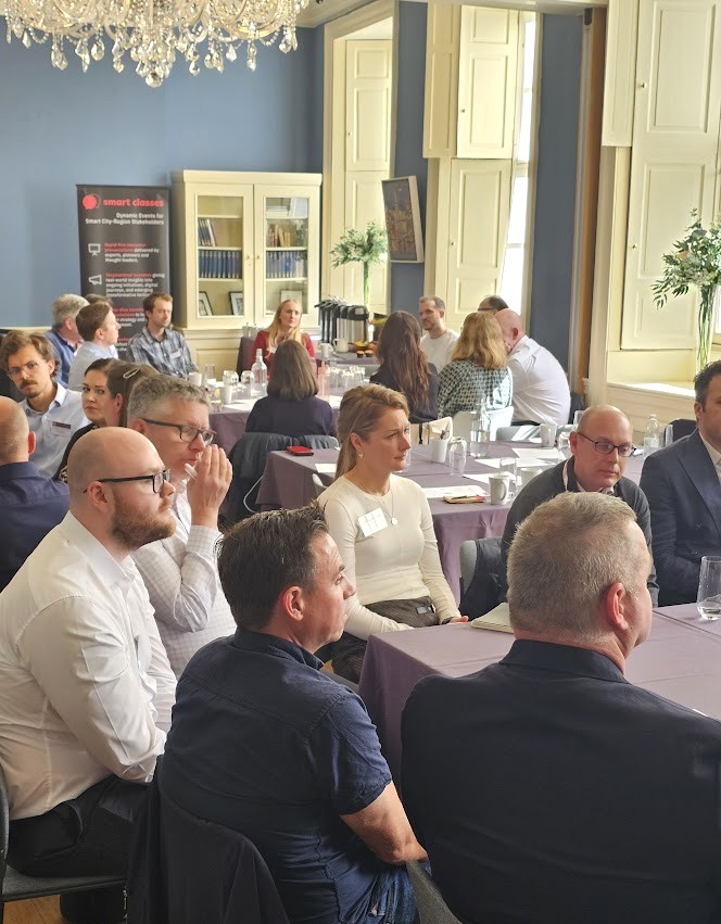
Those qualifying to receive the rich presentation content from this event include commissioning, procurement, trialling, partnering and policy leads, senior influencers, strategic decision makers, programme managers and planners from local authorities (e.g. city, borough, metropolitan, district and county councils); public transport operators; regional transport partnerships, sub-regional transport bodies, combined authorities, integrated transport authorities and passenger transport executives; highways authorities and road operators; government and supporting national transport agencies; non-governmental organisations; fleet operators, parking operators, prime contractors etc.